.
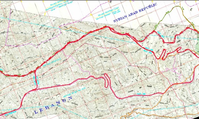
» Study of Alternatives for Toufail Road Details
Category:
Transportation
Client:
Banque Du Liban
Region:
Lebanon
Starting Date:
2008
Completion Date:
2008
Details:
Preparation of topographical maps for different possible alternative routes from Bekaa to Toufail based on 1/20000 base maps & digital satellite photography coverage. Preparation of plans and profiles; field exploration of alternatives, estimation of quantities and costs, and preparation of a comparative study factoring in technical, administrative and financial criteria.
» OTHER PROJECTS
Design and Supervision of Execution of Zahrani Refinery Port
Surveying of existing port with its old deteriorated jetty, design of the reconstruction … »
Street Lighting and Electrical Networks for Zahrani – Tyre and Joaya – Tebnine Roads
In line with the policy implemented by the Ministry of Public Works and … »
Management Assistance and Advising to the Chairman of the Board and Director General … »
Road Network Maintenance in the Caza of Zahlé
The length of the road network within the Caza of Zahlé is around … »
Full design for the Qarqaf Primary Public School in North Lebanon including site … »